An Uncommon Drifter in the Denmark Strait
In the summer of 2026, an unusually large iceberg was spotted drifting in the Denmark Strait, significantly farther south than its presumed origin. Greenland's coastline is characterized by fjords, many containing glaciers that calve icebergs into the sea during the summer months after the sea ice breaks up. While seeing icebergs is common, the size and location of this particular berg, over a thousand kilometers from its apparent source, made it noteworthy.
Captured by the Operational Land Imager (OLI) on Landsat 9 on June 12, 2026, these satellite images show the iceberg in the strait between Greenland and Iceland. It was located just south of Kangikajiip Appalia, a cape on Greenland's east coast, amidst a mix of sea ice and smaller ice fragments, known as "mélange."
Oceanographer Alexis Denton from the International Ice Patrol identified several indicators suggesting it was indeed an iceberg, rather than thick, multi-year sea ice: its proximity to shore, its brighter white color, and its considerable size compared to the surrounding sea ice. On June 12, the iceberg spanned approximately 17 square kilometers (7 square miles), an area about five times larger than New York City's Central Park. While not as colossal as some Antarctic icebergs, it was substantial by Greenland standards.
Keld Quistgaard, a senior ice advisor with the Danish Meteorological Institute’s Greenland Ice Service, stated that the iceberg originated from Jøkelbugten, a bay in northeastern Greenland. However, its precise point of detachment within the bay remains unclear. It's possible the berg broke off from the Zachariæ Isstrøm glacier or its adjacent remnant ice shelf, which once filled the bay before the glacier's rapid retreat in the early 2000s.
Tracking its journey through satellite imagery proved challenging. During spring, the bay and coastal areas were densely packed with sea ice and berg fragments, making individual icebergs difficult to distinguish, especially if covered by snow. In late May, the berg was surrounded by many similar-looking ice formations. Only as it drifted southward and the surrounding ice thinned did it become clearly identifiable.
The berg's size and its distinctive pattern of blue meltwater ponds provided clues about its origin, according to retired University of Maryland glaciologist Christopher Shuman. Shuman believes the berg calved from the remnant ice shelf rather than the glacier itself, as bergs from Zachariæ Isstrøm tend to be smaller. The surface, dotted with meltwater ponds, resembled the remnant shelf ice, which previous satellite images showed drifting south and becoming lodged among islands near the bay, where they were subjected to years of jostling by winds and tides.
By mid-August, the iceberg was approximately 1,500 kilometers (900 miles) from its origin bay, carried southward by the Greenland Coastal Current into the North Atlantic. Quistgaard anticipated the iceberg would gradually disintegrate during August, a process that recent satellite imagery suggested was indeed occurring.
Its breakup in the Denmark Strait means the iceberg's remnants are unlikely to drift into busy shipping lanes near the southern tip of Greenland. Shuman remarked that its journey serves as a reminder of Earth's dynamic nature and the seasonal variations of ice in this part of the North Atlantic.
References & Resources
- NASA Earth Observatory (2015, December 4). Zachariæ Isstrøm Glacier, Greenland.
- Sutherland, D. A., and Pickart, R. S. (2008). The East Greenland Coastal Current: Structure, variability, and forcing. Progress in Oceanography, 78(1), 58-77.
Fresh materials — MMA
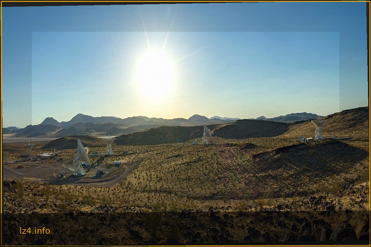
Panorama Showcasing the 34-Meter Antennas of the DSN’s Goldstone Complex
The expansive desert landscape of NASA's Deep Space Network (DSN) Goldstone complex in California is highlighted, featuring several imposing 34-meter (114-foot) satellite dishes. These powerful antennas are crucial for communicating with spacecraft across the vastness of space. Among them is t
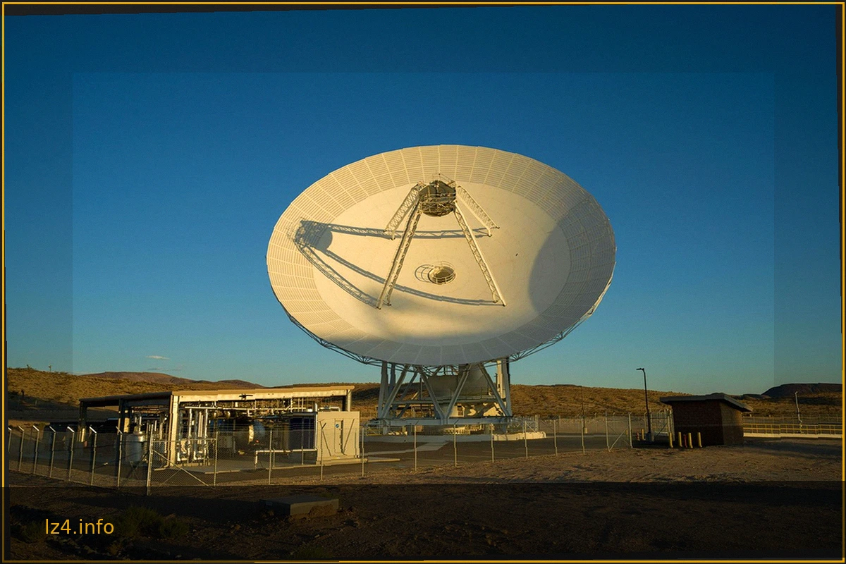
NASA Deep Space Network's New Goldstone Antenna Becomes Operational
The Deep Space Network's (DSN) Goldstone complex, located near Barstow, California, has activated its latest antenna, Deep Space Station 23 (DSS-23). This significant addition is a 34-meter (114-foot) multifrequency beam-waveguide antenna, designed to bolster the DSN's capacity and dramaticall

NASA Deep Space Network: Inauguration of Deep Space Station 23
The Jet Propulsion Laboratory (JPL) and the Deep Space Network (DSN) celebrated a significant milestone with the official ribbon-cutting ceremony for Deep Space Station 23 (DSS-23). This event, held on August 25, 2026, at the Goldstone complex near Barstow, California, marked the completion of

President Honors Artemis II Crew with Congressional Space Medal of Honor
President Donald J. Trump presented the Congressional Space Medal of Honor to NASA astronauts Reid Wiseman, Victor Glover, Christina Koch, and Canadian Space Agency astronaut Jeremy Hansen. This high honor was bestowed upon them for their exceptional service during the Artemis II mission. The

MIT Team Secures Top Honors in NASA's LunaRecycle Challenge for Advanced Space Waste Recycling
NASA has announced the Massachusetts Institute of Technology (MIT) team as the grand prize winner of Phase 2 of its LunaRecycle Challenge. This initiative aims to develop innovative solutions for reducing waste during space missions by recycling common materials such as fabrics, plastics, foam
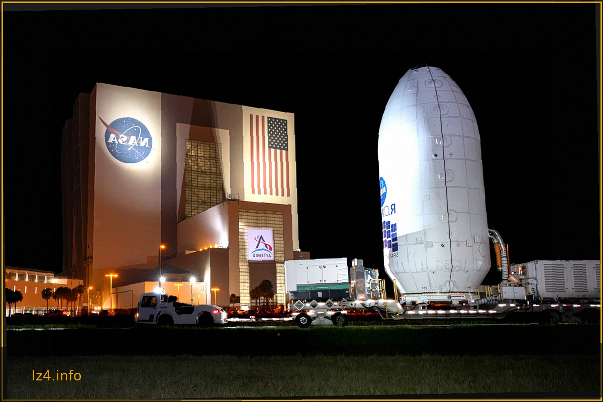
Nancy Grace Roman Space Telescope Moves to SpaceX Hangar for Launch Preparation
The Nancy Grace Roman Space Telescope, a groundbreaking observatory designed to unravel the mysteries of dark energy and dark matter, has reached a significant milestone. Encased within its protective payload fairing, the telescope was transported from NASA's Payload Hazardous Servicing Facili